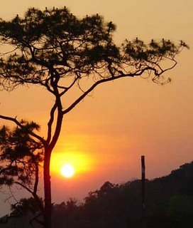
General Information
Phu Soi-dao National Park
Thailand is situated in an approximately area of 78.34 square kilometers or 48,962.5 rai, covering the areas of Pa Nam-pad National Conserved Forest, Tambol Muang-jedton, Tambol Na-khum, Tambol Ban Koak, Ban Koak District, Huai Moon District, Nam-pad District of Uttaradit Province, and Tambol Bor-pak, Chattrakarn District of Pittsanulok Province. The topography of the National Park consist of beautiful virgin forests, which are the sources of streams and rivers. Major sightseeing spots include Phu Soi-dao Waterfall, a beautiful 5-step waterfall situated in an approximate area of 1,000 rai, which can be accessed by an asphaltic road to facilitate the travelling for recreational purpose.
Topography
The geographical features of the National Park consist of high mountains (500-1,800 meters above the sea level), extending northwards and being used as the boundary between Thailand and Laos. The areas of mountains and forests are approximately 85 percent of the total area of the National Park, meanwhile, the areas of flatlands are approximately 15 percent thereof.
Climate
The weather here is very comfortable all year round. Its average highest temperature is about 35.0 degrees celsius and the lowest is about 13.0 degrees celsius or the mid-average is 27.0 degrees celsius. The average rainfall is 1,334.4 milimeters/year. Its raining season starts from May to October while the winter starts from November till February and summer starts from April to June.
Flora and Fauna
The weather at the National Park is cool and breezy throughout the year and can be divided into 3 seasons including the rainy season (May-October), winter (November-February), and summer (April-June). The average highest temperature is 35.0 C and the lowest temperature is 13.0 C, meanwhile, the average temperature is 27.0 C; and the average rainfall is 1,344.4 mm/year.
Phu Soi Dao National Park Huai Moui Sub-district, Amphur Nam Pad Uttaradit Thailand 53110


0 comments:
Post a Comment